Interactive geography tools are revolutionizing the way we engage with the world around us, bringing geography to life in ways that traditional methods simply can’t match. These dynamic resources capture students’ imaginations, fostering a deeper understanding of geographical concepts through interactive engagement and hands-on exploration.
From online mapping applications to immersive virtual reality experiences, the landscape of geography education is evolving rapidly. Educators are increasingly integrating these innovative tools into their classrooms, allowing students to visualize and manipulate geographical data like never before, thereby enhancing retention and interest in the subject matter.
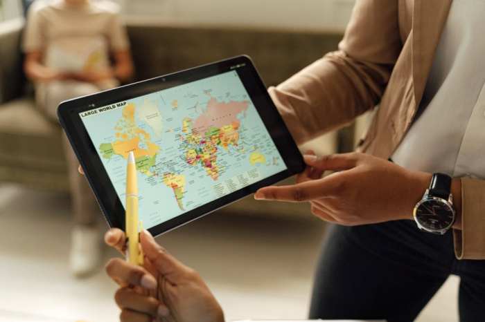
Interactive Geography Tools in Education
Interactive geography tools have revolutionized the way geography is taught and learned in educational settings. These tools, which include digital maps, GIS applications, and interactive simulations, create immersive learning experiences that engage students in ways that traditional methods often cannot. By harnessing technology, educators can bring geographical concepts to life, making them more accessible and relatable for students.The significance of interactive geography tools lies in their ability to enhance student engagement and retention of knowledge.
Unlike conventional teaching methods that primarily rely on textbooks and static visuals, interactive tools allow students to explore geographical concepts dynamically. For example, students can manipulate variables in a simulation to see how different factors influence climate patterns or urban development. This active participation fosters a deeper understanding of complex geographical relationships and processes.
Comparison of Traditional Geography Teaching Methods and Interactive Tools
When examining traditional geography teaching methods alongside interactive tools, several key advantages of the latter emerge. Traditional methods often involve lecture-based instruction and rote memorization, which can lead to disengagement. In contrast, interactive tools promote active learning and critical thinking. Here are some advantages of using interactive geography tools:
- Enhanced Visualization: Interactive maps and 3D models provide visual representations of geographical data, making it easier for students to comprehend spatial relationships.
- Real-Time Data Exploration: Students can analyze real-time data, such as weather patterns or population changes, allowing them to understand geography as a dynamic field.
- Personalized Learning Experiences: Interactive tools often allow for personalized learning paths, enabling students to progress at their own pace and focus on areas of interest.
- Collaborative Learning: Many interactive tools facilitate group projects and discussions, encouraging collaboration among students and enhancing peer-to-peer learning.
- Immediate Feedback: Interactive platforms frequently provide instant feedback on quizzes and activities, helping students understand their mistakes and learn from them promptly.
To illustrate the effectiveness of interactive geography tools, consider a classroom where students use a GIS application to analyze land use changes in their community. They can overlay historical maps with current data to visualize urban sprawl and its impacts. This hands-on approach not only captivates students but also instills a sense of local relevance and critical inquiry into geographical issues.
“The integration of interactive tools in geography education transforms passive learning into an engaging exploration of the world.”
Through these interactive experiences, students are more likely to retain geographical knowledge, as they are actively involved in the learning process. The shift from traditional to interactive methods marks a significant advancement in educational practices within geography, aligning with modern pedagogical approaches that emphasize engagement and critical thinking.
Types of Interactive Geography Tools

Interactive geography tools play a vital role in engaging students and enhancing their understanding of geographical concepts. They enable learners to visualize and interact with geospatial data, making the learning experience more dynamic and immersive. These tools come in various forms, ranging from applications and websites to software programs that facilitate exploration of geographical data and concepts in innovative ways.Numerous interactive geography tools are available for educational purposes, each offering unique features and functionalities.
These tools can be integrated into lesson plans to foster student engagement and improve learning outcomes.
Overview of Interactive Geography Tools
The following categories represent some of the most popular types of interactive geography tools used in educational settings:
- Mapping Tools: Applications like Google Earth and ArcGIS Online provide users with the ability to create and manipulate maps. They allow educators to demonstrate geographic concepts and students to explore terrain and geographic features in 3D.
- GIS Software: Geographic Information Systems (GIS) software such as QGIS offers advanced data analysis capabilities. These tools enable users to visualize, analyze, and interpret spatial data effectively.
- Interactive Simulations: Platforms like PhET Interactive Simulations offer geography-related simulations that help students understand complex geographical phenomena through hands-on interaction.
- Virtual Field Trips: Websites like Google Arts & Culture provide virtual tours of geographical landmarks, allowing students to experience global locations from their classrooms.
- Data Visualization Tools: Tools like Tableau Public enable users to create interactive visualizations of geographical data, enhancing the understanding of trends and patterns in demographics, climate change, and more.
Top-Rated Interactive Geography Apps and Websites
Incorporating high-quality geography tools into the classroom can significantly enhance the educational experience. Below is a list of top-rated interactive geography apps and websites suitable for integration into lesson plans:
- Google Earth: A powerful mapping tool that allows for 3D exploration of the Earth, providing satellite imagery and geographic data overlays.
- ArcGIS Online: Offers comprehensive GIS functionality, enabling users to create custom maps and analyze spatial data.
- National Geographic Education: Provides a wealth of resources, including maps, lesson plans, and interactive activities focused on geography and environmental science.
- GeoGuessr: A fun game that challenges players to guess locations based on random street view images, making geography learning engaging and interactive.
- World Geography Games: An educational platform that includes various games to help students learn about countries, capitals, and geographical features.
Incorporating Interactive Tools into Lesson Plans
Effective integration of interactive geography tools can enhance lesson plans by promoting active learning and critical thinking. Here are several examples of how educators can incorporate these tools:
- Using Google Earth for Virtual Tours: Teachers can design lessons that involve students taking virtual tours of significant geographical locations, discussing their features, and connecting them to historical events.
- Creating Maps with ArcGIS: In geography projects, students can use ArcGIS to create maps that depict various data sets, such as population density or climate patterns, allowing for hands-on data analysis.
- Simulations from PhET: Educators can use interactive simulations to demonstrate concepts such as erosion or plate tectonics, encouraging students to experiment and make predictions based on their observations.
- Incorporating GeoGuessr for Engagement: Teachers can organize competitions or group work where students use GeoGuessr to identify countries or landmarks, fostering a fun and interactive learning environment.
- Utilizing National Geographic Resources: Lesson plans can include activities that leverage National Geographic’s maps and articles, encouraging students to explore real-world issues through a geographical lens.
Future Trends in Interactive Geography Tools
As technology continues to evolve, so does the landscape of interactive geography tools used in education. The future of these tools promises to bring about significant advancements that will enhance teaching and learning experiences. Utilizing innovative technologies, educators can engage students more effectively, making geography more accessible and interactive than ever before.The integration of emerging technologies in interactive geography tools is set to redefine how geographical concepts are taught and understood.
This includes advancements in virtual reality (VR), augmented reality (AR), and artificial intelligence (AI), which are becoming increasingly commonplace in educational settings. The potential for these technologies to create immersive learning environments and provide personalized learning experiences is immense.
Advancements in Technology Impacting Interactive Geography Tools
The future of interactive geography tools is closely tied to the development of several key technologies. These advancements are expected to transform both the tools themselves and the educational methodologies surrounding geography.
- Virtual Reality and Augmented Reality: VR and AR can create immersive environments where students can explore geographical locations as if they were physically there. For instance, a VR application could allow students to walk through ancient civilizations or experience the geographical features of different regions without leaving the classroom.
- Artificial Intelligence: AI can analyze students’ learning patterns and provide tailored learning experiences. For example, AI-driven platforms could suggest specific resources or interactive exercises based on individual performance, ensuring students engage with the material effectively.
- Big Data and Geographic Information Systems (GIS): The use of big data in GIS allows educators to present complex geographical data in interactive formats. This can help students visualize trends and patterns in real-time, enhancing their analytical skills.
- Mobile Technology: The widespread use of smartphones and tablets enables students to access interactive geography tools anytime and anywhere. Mobile applications can facilitate fieldwork and data collection, allowing students to engage with geography outside the classroom.
Methods for Educators to Stay Updated on Geography Education Technologies
To effectively integrate the latest advancements in geography education technologies, educators must remain informed about current trends and tools. There are several methods through which educators can stay updated.
- Professional Development Workshops: Attending workshops focused on educational technology can provide insights into new tools and methodologies. These workshops often feature hands-on experiences with the latest software and applications.
- Online Communities and Forums: Joining online forums, such as those on social media platforms or dedicated educational websites, allows educators to share experiences and learn from one another about effective geography teaching tools.
- Academic Journals and Publications: Subscribing to journals focused on geography education can help educators stay informed about research findings and emerging tools. Many journals also discuss case studies that highlight effective practices and innovative technologies.
- Collaboration with Tech Experts: Partnering with technology firms or educational startups can provide educators with firsthand knowledge about new tools and their potential applications in the classroom.
Transformative Potential of Emerging Trends in Geography Education
Emerging trends in interactive geography tools have the potential to revolutionize how geography is taught and learned in schools. With advancements in technology, the educational landscape is shifting towards more engaging and experiential learning methods.
- Enhanced Engagement: Interactive tools can capture students’ attention more effectively than traditional teaching methods. For example, using VR to explore geographical locations can stimulate interest and curiosity about the world.
- Collaborative Learning: Many interactive tools facilitate group work, encouraging students to collaborate on projects and share insights. This collaboration can enrich their understanding of geographical concepts and develop critical thinking skills.
- Real-Time Data Analysis: The ability to access and analyze real-time geographical data fosters a deeper understanding of current events and trends. Students can study climate change impacts or population movements with up-to-date information, making their learning more relevant.
- Personalized Learning Experiences: With AI integration, lessons can be customized to meet individual student needs, allowing for a more inclusive approach to geography education. This ensures that all students can progress at their own pace and level of understanding.
“The integration of technology in education transforms not just how we teach geography but also how students perceive and interact with the world around them.”
Educational Technology Expert
Wrap-Up
In summary, the advent of interactive geography tools is not just a fleeting trend but a significant shift in educational practices. As technology continues to advance, these tools promise to further enrich the learning experience, making geography not only more accessible but also more compelling for future generations. Embracing these innovations will undoubtedly shape the future of geography education in exciting ways.
Query Resolution
What are interactive geography tools?
They are digital resources that allow users to explore and engage with geographical concepts interactively.
How do these tools improve learning?
They enhance engagement and retention by providing hands-on experiences and visualizations of geographical data.
Can these tools be used for remote learning?
Yes, many interactive geography tools are accessible online, making them perfect for remote and hybrid learning environments.
Are there any free interactive geography tools available?
Yes, several apps and websites offer free access to interactive geography tools suitable for educational purposes.
How can teachers stay updated on new tools?
Teachers can follow educational technology blogs, join professional networks, and attend workshops focused on geography education.


